Covered Bridges of Parke County, Indiana
Postcard series #3
I picked up a group of postcards at a consignment shop featuring covered bridges in Parke County, Indiana. I’m originally from Indiana, so this was of particular interest to me. None of them were written on or had been mailed, but appear to have been purchased for the purpose of keeping.
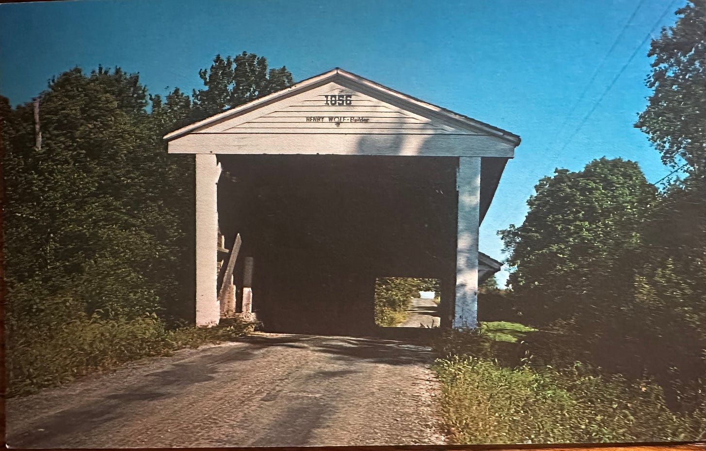
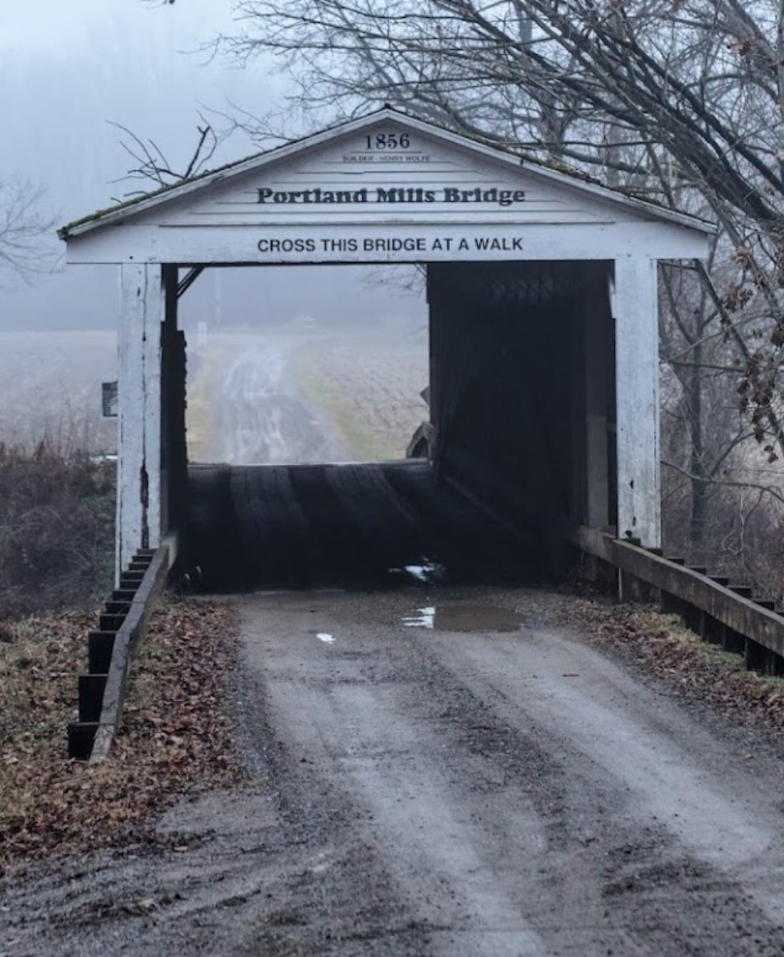
I’m a huge fan of Then and Now photos. I’ve pictured each postcard, its basic information, as well as a photo of the bridge present day, when possible.
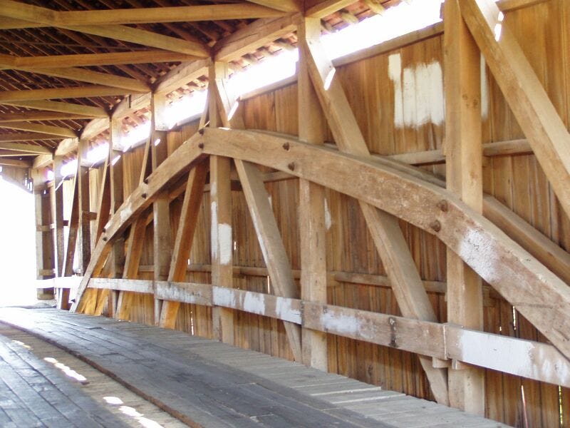
Coal Creek Bridge. This bridge was also known as the Keller Bridge. It was just south of Lodi, Indiana.
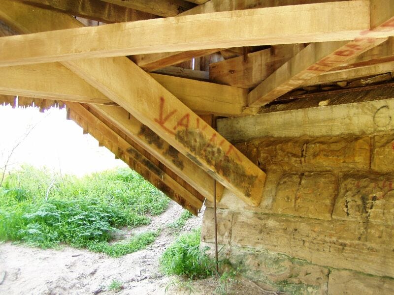
Coal Creek Bridge was built in 1869 over Coal Creek. It is a single-span Burr Arch and was 170 feet long. A Burr arch covered bridge combines multiple arched king post trusses. It was invented in 1804 by Theodore Burr. The combination of the arch and multiple trusses makes the bridge more stable and capable of supporting more weight than either component alone.
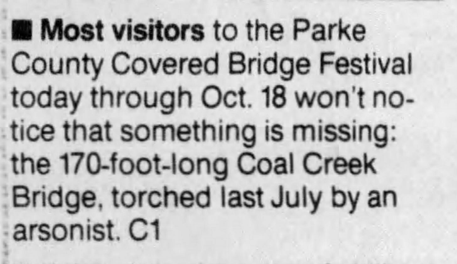
Coal Creek Bridge was built by J.J. Daniels. Sadly, having survived for 123 years, it was uselessly destroyed by arson on Sunday, June 28, 1992. On October 9 of that year, the Indianapolis Star stated that the Parke County Covered Bridge festival was about to begin but that probably most people “won’t notice that something is missing” because is was “torched.” That’s probably all I should say about that.
Bowsher Ford Bridge. This bridge crosses Mill Creek a couple miles northwest of Tangier, Indiana. It was built in 1915 and is 72 feet long and 16 feet wide.
The photographer of this and other postcard photos, John Vincent Pontiere, was the son of John, Sr who emigrated from Italy in 1886 with his family. He married Mary Stella Davis on May 19, 1911 in Hardin County, Kentucky. John, Jr. was one of their three children. Postcard photos of John Pontiere, Jr. are in museums as far away as New Zealand.
In 1974, an oil painting of Bowsher Ford Bridge was donated to the new community High School in Elwood, Indiana, northeast of Indianapolis. The artist was Joe Shell, well-known at the time. His studio was in Nashville, Brown County, Indiana. Brown County is very popular locally for its beautiful autumn foliage and Nashville has long been a quaint tourist town. I’ve visited there several times over the years myself since my home wasn’t too far away.
The Nashville House restaurant was, and maybe still is, famous for its Fried Biscuits. The original Nashville House was built in 1859 and served as a hostelry offering overnight rooms, home-cooked food, and a general store. Of course, this original 2-1/2 story wood structure burned completely to the ground in 1943 and was replaced with another building which still offers the food and store, but no rooming.
Phillips Bridge
Phillips Bridge spans what evidently used to be called Big Pond Creek but is now identified as Rocky Run Creek. It is southeast of Montezuma, Indiana, just east of Sim Smith Bridge as mentioned above.
Phillips Bridge was built in 1909 by J.A. Britton. It is 43 feet long, 16 feet wide, and features a four-segment king post truss. In 2007, it was listed as the shortest covered bridge in Parke County. The Weisner bridge was previously the shortest, but it washed away in 1957.
Big Rocky Fork Bridge
Big Rocky Fork Bridge was built by J.J. Daniels in 1900 near Mansfield, Indiana. The bridge is 72 feet long and 16 feet wide. The structure sits atop a solid limestone block. Limestone is very common in Indiana. In 1900, the bridge cost $1,475.50 to build. It had been severely neglected when a local preservation group began repairing and restoring it in 1991. It now sits next to the modern bridge.
An article in the Boonville Standard in 2007 said Big Rocky Fork Bridge is near one of the areas’ mysteries — a rock grave hidden on a 100-foot high cliff. It doesn’t say if this cliff is along the Rocky Fork Branch, but that is what is implied. Supposedly, no one knows whose grave it is, but a few legends in local folklore offer various explanations. The article did not share what any of these are.
Adams Bridge
Adams bridge has a turbulent history. The original structure was built in 1907 by the Adams Family who owned land in the area. It was to be built by Adams Construction, but they reportedly subcontracted it out to Frankfort Construction. Spanning Little Raccoon Creek, it was a single span Burr arch, 154 feet long and 16 feet wide.
A flood washed out the six-year-old bridge in 1913. It was rebuilt and survived until 1969 when it was destroyed by another flood. I would guess this is the bridge on the postcard. In 1969, the Jessup Covered Bridge was moved to the location to replace the once-again destroyed Adams Bridge. Because the bridge in the photo doesn’t look like a structure hearty enough to have moved, maybe this is the 1913 version. None of the postcards are dated.
Fate is a persistent lady, and again, in 1989, the Jessup bridge was ripped from its foundation by yet another flood and swept downstream. It traveled beneath the State Sanitorium bridge (pictured below) and continued on, breaking completely apart and washing over the concrete bridge at highway 36.
Perhaps finally acknowledging that Little Raccoon Creek did not want a bridge there, it was not replaced. The State Sanitorium bridge still stands, or at least a restored version of it.
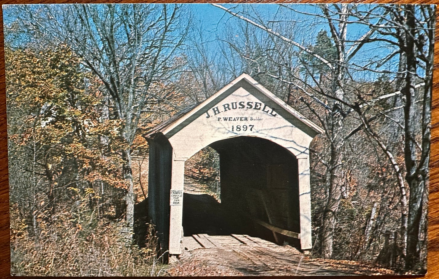
J.H. Russell Bridge
The J.H. Russell Bridge was built on private property north of Annapolis, Indiana. The nearest waterway is Sugar Creek, so this may have been its original location. In 1897, Russell hired brothers Pearly and George Weaver at $2.50 per day to build the bridge. The Weavers used two oaks from woodland on the property. They measured 2-1/2 feet in diameter at the base and were 50 feet long. Poplar was salvaged from an old cabin nearby and used for joists and side posts. Maples and oaks were used for the trusses.
At some point, Ralph Jordan purchased the farm and the bridge. In 1970 the bridge was moved to dry ground to be used as a barn. Because it was not taken care of, it deteriorated and had to be torn down in 1983. It took only thirteen years to let it go to ruin.
Portland Mills Bridge
Built in 1856 across Little Raccoon Creek at the west edge of Portland Mills. This bridge is a single span Burr arch truss, 130 feet long and 16 feet wide. Its present location is not the original one. It was moved because of constant flooding of Big Raccoon Creek, caused by building Lake Mansfield in 1961, also known as building a dam that backed up water, flooding the smaller creeks and farmland in the vicinity. That lake is now called Cecil M. Harden Lake because everything must be named after the highest bidder.
Moving on, Portland Mills bridge was moved in order to replace the Dooley Station Covered Bridge which was senselessly torched by arsonists in 1960 (I wonder why). Its original position is not always agreed upon but the strongest evidence suggests it was in the southeast portion of Greene Township and it is now in the northwest portion.
These are the beautiful bridges I was fortunate enough to find postcards for, but there are many other covered bridges in the county. I hope to visit there very soon and take photos myself.
Any research done on historic structures like these can be disappointing at times. That’s the nature of the passage of time. What irks me, though, is willful destruction, either out of lazy boredom or the “there’s money to be made here” attitude. I think there has been a little of both in these bridge’s history.





Cynthia- I always love a bridge with structures covering. It really makes it more of a permanent place of being rather than just a fleeting one. Makes me think about it longer than I would’ve otherwise. Great reminder.
Most wonderful stories